Wêne:Rhodes NLT Landsat7.png
Mezinahiya vê pêşdîtinê: 605 × 600 pîksel. Resolusyonên din: 242 × 240 pîksel | 484 × 480 pîksel | 775 × 768 pîksel | 1033 × 1024 pîksel | 1948 × 1931 pîksel.
Dosyeya orjînal (1948 × 1931 pixel, mezinbûnê data: 5,65 MB, MIME-typ: image/png)
| Ev pel ji Wikimedia Commonsê ye. Agahdariya li ser rûpela danasîna pelê li jêr tê nîşandan. |
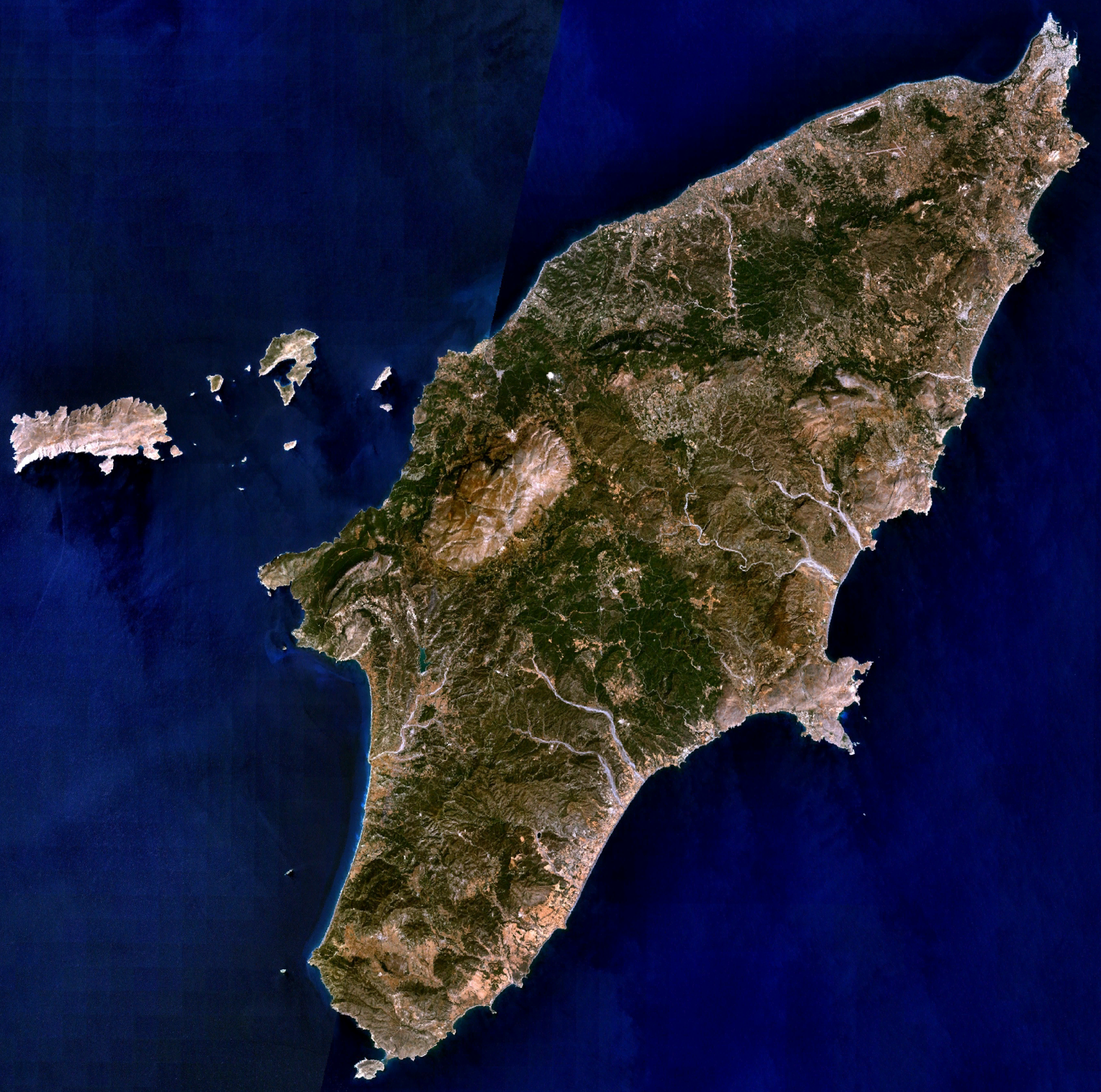
| Danasîn | Visible colour satellite image of Rhodes. | |||
| Çavkanî |
Screenshot from NASA World Wind, NLT Landsat7 layer. Coordinates: worldwind://goto/world=Earth&lat=36.16654&lon=27.93315&alt=80698 |
|||
| Xwedî | Wêne: NASA | |||
| Destûr (Dîsa bikaranînê vê dosyeye) |
|
|||
| Guhartoyên din | Image:Rodas.png |

Dîroka daneyê
Ji bo dîtina guhartoya wê demê bişkoka dîrokê bitikîne.
| Dîrok/Katjimêr | Wêneyê biçûk | Mezinahî | Bikarhêner | Şirove | |
|---|---|---|---|---|---|
| niha | 20:29, 16 nîsan 2006 | | 1948 x 1931 (5,65 MB) | Hautala | {{Information| |Description=Visible colour satellite image of Rhodes. |Source=Screenshot from NASA World Wind, NLT Landsat7 layer. |Date= |Author= |Permission={{PD-WorldWind}} |other_versions= }} |
Bikaranîna pelê
Rûpelekî ku ji vê dosyeyê bi kar tîne nîne.
Bikaranîna gerdûnî ya pelê
Ev wîkiyên di rêzê de vê pelê bi kar tînin:
- Bikaranîna di ab.wikipedia.org de
- Bikaranîna di als.wikipedia.org de
- Bikaranîna di an.wikipedia.org de
- Bikaranîna di ar.wikipedia.org de
- Bikaranîna di az.wikipedia.org de
- Bikaranîna di be-tarask.wikipedia.org de
- Bikaranîna di be.wikipedia.org de
- Bikaranîna di bg.wikipedia.org de
- Bikaranîna di ca.wikipedia.org de
- Bikaranîna di ceb.wikipedia.org de
- Bikaranîna di cs.wikipedia.org de
- Bikaranîna di da.wikipedia.org de
- Bikaranîna di de.wikipedia.org de
- Bikaranîna di el.wikipedia.org de
- Bikaranîna di en.wikipedia.org de
- Bikaranîna di eu.wikipedia.org de
- Bikaranîna di fi.wikipedia.org de
- Bikaranîna di fr.wikipedia.org de
Zêdetir bikaranîna global a vê pelê bibîne.