Wêne:Qitaihe Xuefu St.jpg
Mezinahiya vê pêşdîtinê: 800 × 367 pîksel. Resolusyonên din: 320 × 147 pîksel | 881 × 404 pîksel.
Dosyeya orjînal (881 × 404 pixel, mezinbûnê data: 63 KB, MIME-typ: image/jpeg)
| Ev pel ji Wikimedia Commonsê ye. Agahdariya li ser rûpela danasîna pelê li jêr tê nîşandan. |
Danasîn
| Danasîn |
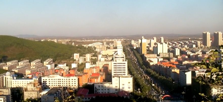
English: View east at 4:30 pm local time along Xuefu St (学府街) from Tao Hill (桃山) in Qitaihe, China. The southern slope of Xianhudong(仙湖洞)Hill is apparent in the left of this screen capture from a Sanyo Xacti CS-1 video. 中文(简体):学府街在七台河(黑龙江省) |
|||
| Dîrok | ||||
| Çavkanî | Min çêkir | |||
| Xwedî | Brian Dell | |||
| Destûr (Dîsa bikaranînê vê dosyeye) |
I, the copyright holder of this work, hereby publish it under the following license:
|
| Şûnda kamerayê | | Ev wêne û yên din li ser OpenStreetMap |
|---|
Dîroka daneyê
Ji bo dîtina guhartoya wê demê bişkoka dîrokê bitikîne.
| Dîrok/Katjimêr | Wêneyê biçûk | Mezinahî | Bikarhêner | Şirove | |
|---|---|---|---|---|---|
| niha | 14:23, 22 îlon 2011 | | 881 x 404 (63 KB) | Bdell555 |
Bikaranîna pelê
Ev rûpelên li jêr vê dosyeyê bi kar tînin:
Bikaranîna gerdûnî ya pelê
Ev wîkiyên di rêzê de vê pelê bi kar tînin:
- Bikaranîna di ar.wikipedia.org de
- Bikaranîna di ceb.wikipedia.org de
- Bikaranîna di cs.wikipedia.org de
- Bikaranîna di en.wikipedia.org de
- Bikaranîna di es.wikipedia.org de
- Bikaranîna di eu.wikipedia.org de
- Bikaranîna di fa.wikipedia.org de
- Bikaranîna di fi.wikipedia.org de
- Bikaranîna di fr.wikipedia.org de
- Bikaranîna di id.wikipedia.org de
- Bikaranîna di it.wikipedia.org de
- Bikaranîna di ja.wikipedia.org de
- Bikaranîna di ki.wikipedia.org de
- Bikaranîna di ko.wikipedia.org de
- Bikaranîna di nn.wikipedia.org de
- Bikaranîna di no.wikipedia.org de
- Bikaranîna di pam.wikipedia.org de
- Bikaranîna di pl.wikipedia.org de
- Bikaranîna di pt.wikipedia.org de
- Bikaranîna di ru.wikipedia.org de
- Bikaranîna di sr.wikipedia.org de
- Bikaranîna di sv.wikipedia.org de
- Bikaranîna di tr.wikipedia.org de
- Bikaranîna di uk.wikipedia.org de
- Bikaranîna di ur.wikipedia.org de
- Bikaranîna di www.wikidata.org de
- Bikaranîna di wuu.wikipedia.org de
- Bikaranîna di zh.wikipedia.org de
- Bikaranîna di zh.wikivoyage.org de