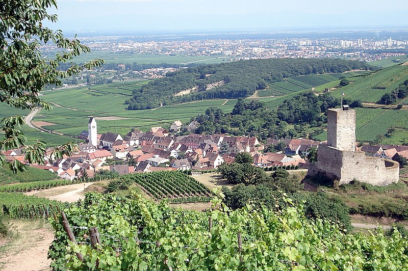
Wêne:Katzenthal1.JPG

Mezinahiya vê pêşdîtinê: 800 × 532 pîksel. Resolusyonên din: 320 × 213 pîksel | 640 × 426 pîksel | 1024 × 681 pîksel | 1280 × 852 pîksel | 1632 × 1086 pîksel.
Dosyeya orjînal (1632 × 1086 pixel, mezinbûnê data: 902 KB, MIME-typ: image/jpeg)
Dîroka daneyê
Ji bo dîtina guhartoya wê demê bişkoka dîrokê bitikîne.
| Dîrok/Katjimêr | Wêneyê biçûk | Mezinahî | Bikarhêner | Şirove | |
|---|---|---|---|---|---|
| niha | 20:00, 13 çiriya pêşîn 2008 |  | 1632 x 1086 (902 KB) | Torsade de Pointes | {{Information |Description={{fr|1=Le village de Katzenthal, dép. du Haut-Rhin, Alsace, France. À l'avant-plan: château ruiné du Wineck, entouré de vignobles. En contrebas, le village. À l'arrière-plan: la plaine d'Alsace, où s'étire l'agglomérat |
Bikaranîna pelê
Ev rûpelên li jêr vê dosyeyê bi kar tînin:
Bikaranîna gerdûnî ya pelê
Ev wîkiyên di rêzê de vê pelê bi kar tînin:
- Bikaranîna di als.wikipedia.org de
- Bikaranîna di br.wikipedia.org de
- Bikaranîna di ca.wikipedia.org de
- Bikaranîna di ce.wikipedia.org de
- Bikaranîna di de.wikipedia.org de
- Bikaranîna di diq.wikipedia.org de
- Bikaranîna di en.wikipedia.org de
- Bikaranîna di es.wikipedia.org de
- Bikaranîna di eu.wikipedia.org de
- Bikaranîna di fr.wikipedia.org de
- Bikaranîna di hu.wikipedia.org de
- Bikaranîna di it.wikipedia.org de
- Bikaranîna di lb.wikipedia.org de
- Bikaranîna di nl.wikipedia.org de
- Bikaranîna di oc.wikipedia.org de
- Bikaranîna di pfl.wikipedia.org de
- Bikaranîna di pl.wikipedia.org de
- Bikaranîna di pt.wikipedia.org de
- Bikaranîna di ro.wikipedia.org de
- Bikaranîna di ru.wikipedia.org de
- Bikaranîna di sk.wikipedia.org de
- Bikaranîna di sl.wikipedia.org de
- Bikaranîna di sr.wikipedia.org de
- Bikaranîna di sv.wikipedia.org de
- Bikaranîna di tt.wikipedia.org de
- Bikaranîna di uk.wikipedia.org de
- Bikaranîna di uz.wikipedia.org de
- Bikaranîna di vec.wikipedia.org de
- Bikaranîna di www.wikidata.org de
- Bikaranîna di zh-min-nan.wikipedia.org de
- Bikaranîna di zh.wikipedia.org de
