Wêne:Antarctica relief location map.jpg

Mezinahiya vê pêşdîtinê: 600 × 600 pîksel. Resolusyonên din: 240 × 240 pîksel | 480 × 480 pîksel | 768 × 768 pîksel | 1024 × 1024 pîksel | 1493 × 1493 pîksel.
Dosyeya orjînal (1493 × 1493 pixel, mezinbûnê data: 459 KB, MIME-typ: image/jpeg)
| Ev pel ji Wikimedia Commonsê ye. Agahdariya li ser rûpela danasîna pelê li jêr tê nîşandan. |
Danasîn
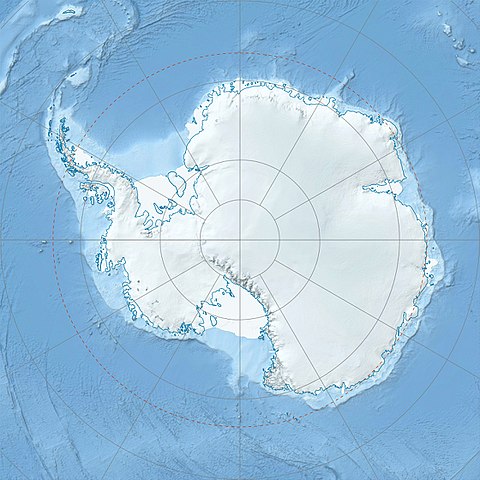
| Danasîn |
Deutsch: Physische Positionskarte Antarktis, Mittabstandstreue Azimutalprojektion
English: Physical Location map Antarctica, Azimuthal equidistant projection
|
| Dîrok | |
| Çavkanî |
Min çêkir
|
| Xwedî | Alexrk2 |
| Guhartoyên din |
|

Derivative works


|
This map has been made or improved in the German Kartenwerkstatt (Map Lab). You can propose maps to improve as well.
|
Lîsans
I, the copyright holder of this work, hereby publish it under the following license:
Ev pel di bin lîsansa Creative Commons Attribution-Share Alike 3.0 Unported de lîsanskirî ye.
- Tu azad î:
- parve bike – ji bo kopîkirin, belavkirin û weşandina xebatê
- ji bo guhartin û adaptekirina naverokê – ji bo adaptekirina xebatê
- Di bin van mercan de:
- isnad – Divê tu isnadeke maqûl bikî, lînekek pêşkêş bikî ji bo lîsansê, û diyar bikî ku guhartin hatiye kirin an na. Tu dikarî vê yekê bi adilî bi cih bînî, lê ne bi awayê ku wekî lîsansor te an bikaranîna te pejirandibe.
- parvekirinê mîna hev – Ger tu materyalê biguherînî, bizivirînî formeke din, an ava bikî divê beşdariyên xwe di bin eynî lîsansê an lîsansa hevaheng de wekî ya eslî belav bikî.
Dîroka daneyê
Ji bo dîtina guhartoya wê demê bişkoka dîrokê bitikîne.
| Dîrok/Katjimêr | Wêneyê biçûk | Mezinahî | Bikarhêner | Şirove | |
|---|---|---|---|---|---|
| niha | 07:52, 26 tîrmeh 2017 | | 1493 x 1493 (459 KB) | Amga | Reverted to version as of 16:03, 3 May 2011 (UTC). This is used in location maps, so don't rotate it! |
| 00:00, 26 tîrmeh 2017 |  | 1488 x 1493 (458 KB) | SteinsplitterBot | Bot: Image rotated by 90° | |
| 16:03, 3 gulan 2011 |  | 1493 x 1493 (459 KB) | Alexrk2 | light blue hypso colors | |
| 21:24, 21 sibat 2010 |  | 1500 x 1500 (818 KB) | Alexrk2 | == Summary == {{Information |Description= {{de|Physische Positionskarte Antarktis, Mittabstandstreue Azimutalprojektion}} {{en|Physical Location map Antarctica, Azimuthal equidistant projection}} * Longitude of central |
Bikaranîna pelê
Ev 4 rûpel li jêr vê dosyeyê bi kar tînin:
Bikaranîna gerdûnî ya pelê
Ev wîkiyên di rêzê de vê pelê bi kar tînin:
- Bikaranîna di af.wikipedia.org de
- Bikaranîna di ar.wikipedia.org de
- Bikaranîna di arz.wikipedia.org de
- Bikaranîna di ast.wikipedia.org de
- Bikaranîna di az.wikipedia.org de
- Şablon:Yer xəritəsi Antarktida
- Antarktik yarımadası
- Şablon:Yer xəritəsi Antarktida (fiziki)
- Antarktik boğazı
- Jerlaş boğazı
- Bransfild boğazı
- Lemeir boğazı
- Vostok gölü
- Friksel gölü
- Mak-Medro boğazı
- Veddell dənizi
- Birlik dənizi
- Riser-Larsen dənizi
- Kosmonavtlar dənizi
- Mouson dənizi
- Dürvil dənizi
- Somov dənizi
- Kral VII Haakon dənizi
- Deyvis dənizi
- Lazarev dənizi
- Bellinshauzen dənizi
- Amundsen dənizi
- Ross dənizi
- Skotia dənizi
- Mouson yarımadası
- Hat Point yarımadası
- I Aleksandr Torpağı
- Berkner
- Ross adası
- Erebus vulkanı
- Saypl
- Terston
- Karney
- Ruzvelt adası (Antarktida)
- Sifre burnu
- Cənubi Şetland adaları
- Cənubi Orkney adaları
- Koroneyşen
Zêdetir bikaranîna global a vê pelê bibîne.