Wêne:Southern Ocean.png
Versyonekî jê mezintir tune.
Southern_Ocean.png (330 × 330 pixel, mezinbûnê data: 10 KB, MIME-typ: image/png)
| Ev pel ji Wikimedia Commonsê ye. Agahdariya li ser rûpela danasîna pelê li jêr tê nîşandan. |

|
This locator map image could be re-created using vector graphics as an SVG file. This has several advantages; see Commons:Media for cleanup for more information. If an SVG form of this image is available, please upload it and afterwards replace this template with
{{vector version available|new image name}}.
It is recommended to name the SVG file “Southern Ocean.svg”—then the template Vector version available (or Vva) does not need the new image name parameter. |
Danasîn
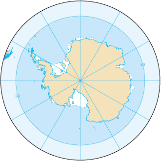
Southern_Ocean (from en:) Map from CIA Factbook 2003: Southern Ocean archive copy at the Wayback Machine (picture link is [1]).
![[1]](https://www.cia.gov/library/publications/the-world-factbook/maps/oo-map.gif)
English version: File:Southern Ocean - en.png Slovene version: File:Southern Ocean-sl.png
Lîsans
This image is in the public domain because it contains materials that originally came from the United States Central Intelligence Agency's World Factbook.
|
 |
Dîroka daneyê
Ji bo dîtina guhartoya wê demê bişkoka dîrokê bitikîne.
| Dîrok/Katjimêr | Wêneyê biçûk | Mezinahî | Bikarhêner | Şirove | |
|---|---|---|---|---|---|
| niha | 20:16, 22 tebax 2009 | | 330 x 330 (10 KB) | Serg!o | language neutral map |
| 11:52, 3 çiriya paşîn 2004 |  | 330 x 330 (10 KB) | Maximaximax | Southern_Ocean (from en:) Map from [http://www.cia.gov/cia/publications/factbook/geos/oo.html CIA Factbook 2003: Southern Ocean] (picture link is [http://www.cia.gov/cia/publications/factbook/maps/oo-map.gif]). |
Bikaranîna pelê
Ev rûpelên li jêr vê dosyeyê bi kar tînin:
Bikaranîna gerdûnî ya pelê
Ev wîkiyên di rêzê de vê pelê bi kar tînin:
- Bikaranîna di af.wikipedia.org de
- Bikaranîna di an.wikipedia.org de
- Bikaranîna di arc.wikipedia.org de
- Bikaranîna di ar.wikipedia.org de
- Bikaranîna di as.wikipedia.org de
- Bikaranîna di azb.wikipedia.org de
- Bikaranîna di az.wikipedia.org de
- Bikaranîna di bat-smg.wikipedia.org de
- Bikaranîna di ba.wikipedia.org de
- Bikaranîna di be-tarask.wikipedia.org de
- Bikaranîna di be.wikipedia.org de
- Bikaranîna di bjn.wikipedia.org de
- Bikaranîna di bs.wikipedia.org de
- Bikaranîna di bxr.wikipedia.org de
- Bikaranîna di ca.wikipedia.org de
- Bikaranîna di cs.wikipedia.org de
- Bikaranîna di cv.wikipedia.org de
- Bikaranîna di da.wikipedia.org de
- Bikaranîna di da.wiktionary.org de
- Bikaranîna di el.wikipedia.org de
- Bikaranîna di en.wikipedia.org de
- Bikaranîna di en.wikibooks.org de
- Bikaranîna di en.wikiversity.org de
- Bikaranîna di en.wiktionary.org de
Zêdetir bikaranîna global a vê pelê bibîne.