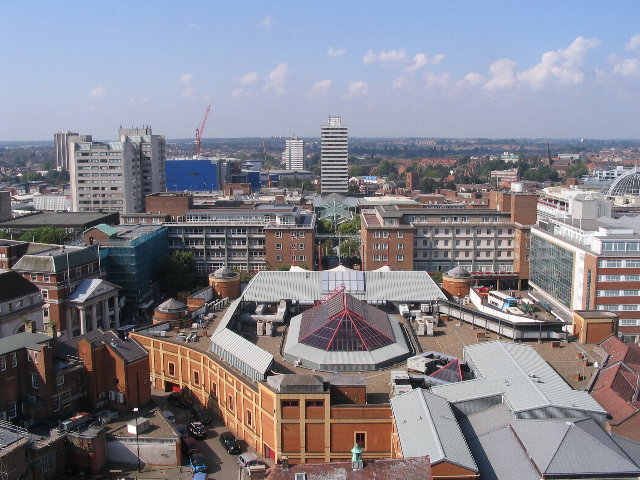
Wêne:Broadgate and Precincts - geograph.org.uk - 554599.jpg
Broadgate_and_Precincts_-_geograph.org.uk_-_554599.jpg (640 × 480 pixel, mezinbûnê data: 96 KB, MIME-typ: image/jpeg)
Dîroka daneyê
Ji bo dîtina guhartoya wê demê bişkoka dîrokê bitikîne.
| Dîrok/Katjimêr | Wêneyê biçûk | Mezinahî | Bikarhêner | Şirove | |
|---|---|---|---|---|---|
| niha | 02:26, 6 sibat 2011 |  | 640 x 480 (96 KB) | GeographBot | == {{int:filedesc}} == {{Information |description={{en|1=Broadgate and Precincts Taken from the tower of the old cathedral church of St. Michael, looking westwards down the line of the Upper and Lower Precinct shopping areas towards Mercia House[1], the t |
Bikaranîna pelê
Ev rûpelên li jêr vê dosyeyê bi kar tînin:
Bikaranîna gerdûnî ya pelê
Ev wîkiyên di rêzê de vê pelê bi kar tînin:
- Bikaranîna di af.wikipedia.org de
- Bikaranîna di an.wikipedia.org de
- Bikaranîna di ar.wikipedia.org de
- Bikaranîna di arz.wikipedia.org de
- Bikaranîna di ast.wikipedia.org de
- Bikaranîna di azb.wikipedia.org de
- Bikaranîna di az.wikipedia.org de
- Bikaranîna di be-tarask.wikipedia.org de
- Bikaranîna di be.wikipedia.org de
- Bikaranîna di ca.wikipedia.org de
- Bikaranîna di ceb.wikipedia.org de
- Bikaranîna di cs.wikipedia.org de
- Bikaranîna di cy.wikipedia.org de
- Bikaranîna di da.wikipedia.org de
- Bikaranîna di de.wikipedia.org de
- Bikaranîna di de.wikivoyage.org de
- Bikaranîna di diq.wikipedia.org de
- Bikaranîna di el.wikipedia.org de
- Bikaranîna di en.wikipedia.org de
- Bikaranîna di en.wikivoyage.org de
- Bikaranîna di eo.wikipedia.org de
- Bikaranîna di es.wikipedia.org de
- Bikaranîna di eu.wikipedia.org de
- Bikaranîna di frr.wikipedia.org de
- Bikaranîna di fr.wikipedia.org de
- Bikaranîna di fr.wikivoyage.org de
- Bikaranîna di fy.wikipedia.org de
- Bikaranîna di ga.wikipedia.org de
- Bikaranîna di gl.wikipedia.org de
- Bikaranîna di he.wikivoyage.org de
- Bikaranîna di hy.wikipedia.org de
- Bikaranîna di lld.wikipedia.org de
- Bikaranîna di lv.wikipedia.org de
- Bikaranîna di mdf.wikipedia.org de
- Bikaranîna di mzn.wikipedia.org de
- Bikaranîna di nn.wikipedia.org de
- Bikaranîna di no.wikipedia.org de
- Bikaranîna di os.wikipedia.org de
- Bikaranîna di pl.wikipedia.org de
- Bikaranîna di pl.wikivoyage.org de
- Bikaranîna di pnb.wikipedia.org de
- Bikaranîna di ro.wikipedia.org de
- Bikaranîna di ru.wikinews.org de
- Bikaranîna di sco.wikipedia.org de
Zêdetir bikaranîna global a vê pelê bibîne.

